

On August 17, 2026, a 68-year-old visitor from France died after his vehicle got stuck in mud on West Side Road. Here is what the park reported, and what NPS says to do if it happens to you.
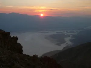
Death Valley West Side Road runs along the western edge of Badwater Basin, at the foot of the Panamint Range. Badwater Road, the paved road on the east side of the basin, runs along the other side of the salt flats. Both ends of the dirt road connect back to that pavement, and on a map the two roads look close together. On Monday, August 17, 2026, two men from France were driving West Side Road in Death Valley National Park when their vehicle got stuck in mud. They started walking across the salt flats toward Badwater Road. The temperature that day reached 116°F (46.7°C). One of them, 68-year-old Pierre Michel Formosa, died.
This post sticks to what the National Park Service has published. The park's news release is short, and it said the Inyo County coroner would determine the cause and manner of death. What follows is the official account, the basics of the road itself, and the park's own guidance on heat, mud, stuck vehicles, and calling for help. Nothing here is a judgment of the two men. It is the information worth having in hand before driving any valley-floor road in Death Valley, and most of all in summer.
What the Park Service Reported
The National Park Service published its account on August 21, 2026, four days after the incident. The release opens plainly: "A 68-year-old French visitor died Monday, Aug. 17, after he and a traveling companion became stranded on a remote road in Death Valley National Park." It then names him. "Pierre Michel Formosa, 68, and his travel companion, both from France, were traveling on West Side Road when their vehicle became stuck in mud near Queen of Sheba Mine Road."
"With no other vehicles in the area, the men began walking across the salt flats toward Badwater Road to seek assistance. Temperatures reached 116°F that day." According to the release, "After about 1.3 miles, the man was unable to continue." That is about 2.1 kilometers. His companion kept going toward Badwater Road. He "eventually received assistance from a passing motorist and reported the incident at the Furnace Creek Visitor Center shortly after 2 p.m."
The search started quickly once the report came in. "National Park Service rangers and an Inyo County deputy began a search and rescue operation about 2:13 p.m. A California Highway Patrol helicopter joined the search and located the man later that afternoon, approximately 1.5 miles from Badwater Road. He was pronounced dead at the scene." That second distance is about 2.4 kilometers. The release closes the account with one line: "The Inyo County coroner will determine the cause and manner of death."
Death Valley National Park Superintendent Mike Reynolds added a statement, quoted here in full. "Our deepest condolences are with the family and friends of the visitor who died. This is a heartbreaking reminder of how quickly conditions here can turn dangerous. Death Valley is an extraordinary place, but its heat, distances, and remoteness can be dangerous, regardless of experience. We're grateful to everyone who took part in the search, and our thoughts are with his loved ones."
What the Record Does Not Say
The release leaves a lot out. It does not say what vehicle the men were driving or how much water they carried. It does not say when the vehicle got stuck or when they started walking. There is no total distance from the vehicle to the pavement, and nothing about the route the men took across the flats. The release says nothing about their desert experience, and the cause and manner of death were left to the coroner.
The release does include one line that applies to everyone who drives here: "Death Valley National Park covers vast, remote terrain where cell service is limited or nonexistent, and emergency help can be hours away." Alongside the account, the park published seven planning points for visitors. Those points, plus the park's longer backcountry guidance, are the backbone of the rest of this article.
Where West Side Road Goes
Length and Route
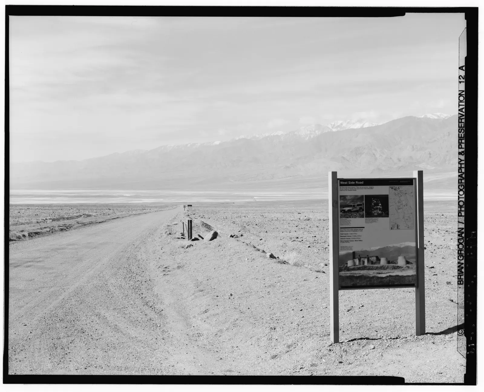
The Park Service lists West Side Road as about 40 miles (64 km) long. A 2015 park release describes it as "a 40-mile-long graded road that parallels Badwater Road on the west side of Death Valley," and the park's biking page gives the same 40 miles, starting 6 miles (10 km) south of Highway 190 on Badwater Road. One independent route guide, Ordealist, measures the centerline between the two junctions at closer to 36 miles (58 km). Either way, it is a long stretch of dirt with no services.
The road runs along the western edge of the Badwater Basin floor, west of Badwater Road, with the Panamint Range rising above it. According to the park's Backcountry and Wilderness Access Map, it follows the "Historic route of the 20-mule team wagons" and "skirts the west side of Badwater Basin." Badwater Road runs along the east side of the same basin. The salt flats lie in between. That layout is the reason the paved road can look so close from the dirt one.
Surface and Vehicle
Two different questions get mixed up here: how much ground clearance you need, and whether you need four-wheel drive. The backcountry map rates West Side Road "High-clearance due to washboard, deep gravel, and sand" and warns that the "Amargosa River crossing at southern end may be impassable when flowing." The 2015 release called it "passable by two-wheel-drive vehicles," and a photo caption in that release describes it as "a 2-wheel-drive unpaved road that provides access to rougher 4x4 roads." Those two statements fit together. A high-clearance vehicle does not have to be four-wheel drive.
The route guides read it the same way. Ordealist says high clearance is needed for the washboard, gravel, and sand, but "No four-wheel drive required on the road itself," while the canyon roads that branch off it need 4WD past their alluvial fans. Walking Wild and Free rates it as a high-clearance dirt and gravel road. Keep in mind that the 2015 description is older, and all of these ratings assume a dry road. Mud on the valley floor is a different problem from washboard. The park's planning point on vehicles says it directly: "Match your vehicle to the road. Many backcountry roads require high-clearance or four-wheel-drive vehicles, and conditions can change without warning."
Day Use Only and the Canyon Roads
West Side Road is not a camping road. The backcountry map lists it among the dirt roads that are day use only, and the valley-floor camping closure runs from Ashford Mill north to Mesquite Flat. If you are out there, plan to be back on pavement the same day.
The road also provides access to the canyons above it. The NPS West Side Road page says it "provides access to 4x4 roads and cross-country hiking in the Panamint Mountains," and the map names Trail Canyon, Hanaupah Canyon, Johnson Canyon, and Warm Springs Canyon. Queen of Sheba Mine Road, the landmark in the release, is not one of the roads the NPS map names. The route guides put its junction about 25.7 miles (41 km) from the north end of West Side Road, and they describe the spur itself as a high-clearance or four-wheel-drive road. The release places the stuck vehicle "near" that junction, on West Side Road, not up the spur.
Death Valley West Side Road After the Floods
West Side Road has spent a good part of the last few years closed. The NPS West Side Road page puts it bluntly: "August 20, 2023 was the rainiest day in Death Valley National Park's history. The remnants of Hurricane Hilary caused flash floods that closed the entire park for 56 days and damaged over 1,000 miles of park roads." That is more than 1,600 kilometers of road. A section of West Side Road washed away, and the same page says "About two miles of the road were left too soggy and unstable for heavy equipment to work on."
Those two miles (3.2 km) had to wait. The temporary lake that formed on the basin floor after the storms, nicknamed "Lake Manly," kept the ground soaked through the winter, and crews could only finish once it dried and firmed up over the summer. Most of the work was paid for through the Federal Highway Administration's Emergency Relief for Federally Owned Roads (ERFO) program, with extra culverts added to make the road more resilient to future floods. The road "fully reopened on 1/31/2025."
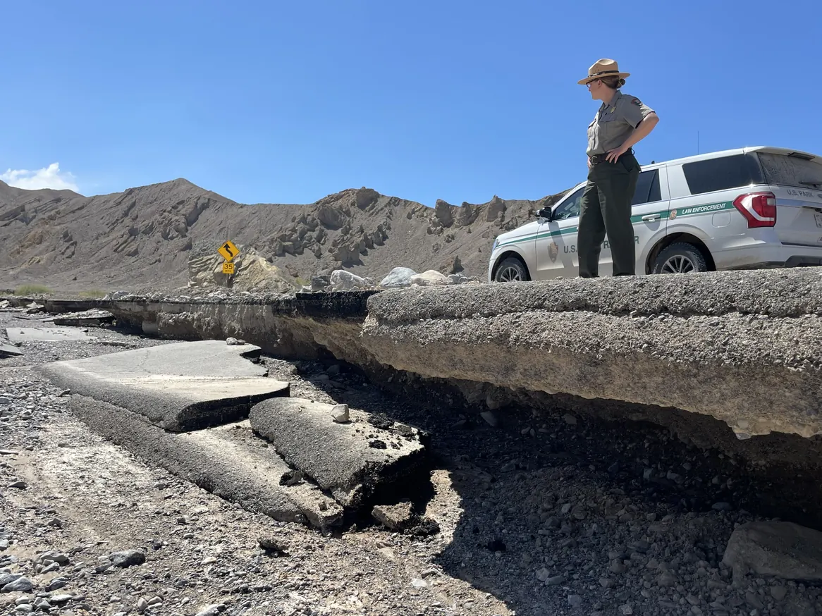
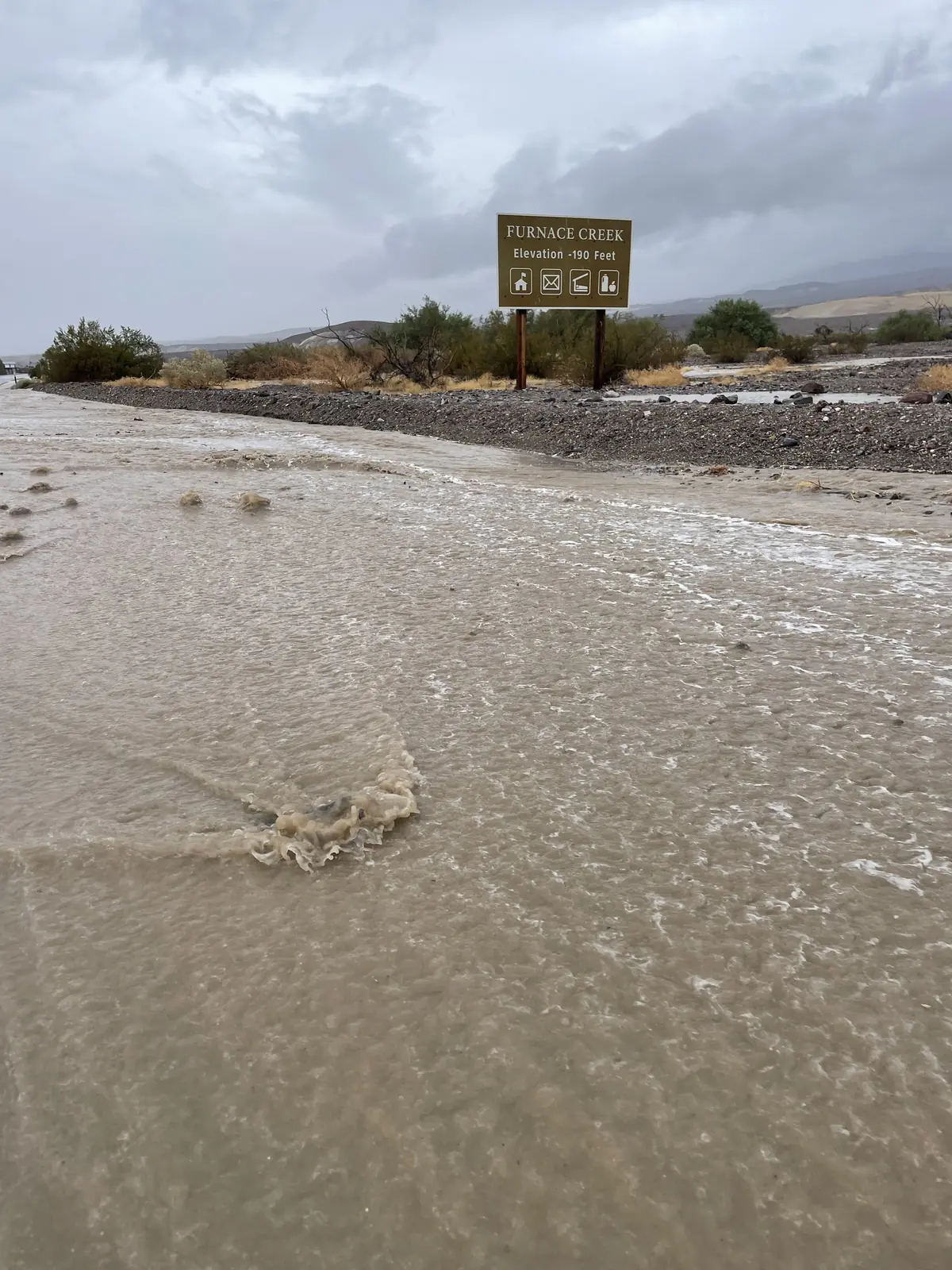
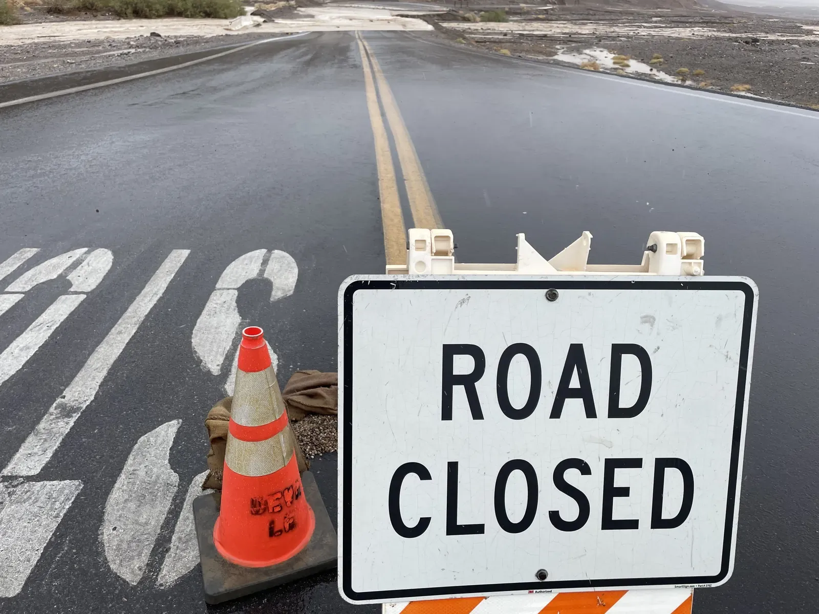
Reopened does not mean it stays open. On November 15, 2025, a storm dropped 0.6 inches (1.5 cm) of rain at Furnace Creek, which the park noted was "more than a quarter of the annual rainfall for Death Valley." West Side Road was on the closure list along with all of Badwater Road, North Highway, Twenty Mule Team Canyon, and Charcoal Kilns Road. Notice that the paved road on the other side of the basin closed too. The park's advice in that release is worth remembering for any dirt road here: "Unpaved roads may be impassable due to mud flows or erosion. Proceed with caution and be prepared to self-rescue."
As of the road status dated September 28, 2026, on the park's Alerts and Conditions page, West Side Road was not listed as closed or under caution. Hunter Mountain Road was closed, though, because extremely muddy conditions had led to multiple stuck vehicles. That is the same problem in a different corner of the park. The page often changes, so check it the day you drive, for West Side Road and for Badwater Road, not the week before.
How a Desert Road Turns to Mud
"Stuck in mud" sounds strange for a park that gets less than 2 inches of rain in a normal year. The park's weather page lists average annual precipitation at 1.94 inches (4.9 cm), and in 1929 and 1953 no rain was recorded at all. The catch is that when it does rain, it can rain a lot at once.
The recent record shows it. On August 5, 2022, Furnace Creek got 1.70 inches (4.3 cm) of rain, which the NPS now recognizes as the rainiest day at that point, about three-quarters of a normal year. NPS statements reported by Reuters put about 1,000 people stranded in the park that day, roughly half visitors and half employees, with about 60 vehicles buried in debris. Then on August 20, 2023, the National Weather Service gauge at Furnace Creek measured 2.2 inches (5.6 cm), more than the park's annual average, and radar suggested some parts of the park got around 5 inches (13 cm).
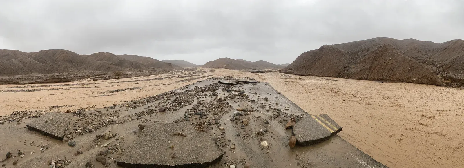
Ranger Abby Wines explained where all that water goes in the park's 2023 closure release. "Picture the mountains in Death Valley as being a steep building roof. Just like a roof, the rocky slopes don't absorb much water. The canyons function like a rain spout, channeling that runoff. However, in Death Valley that runoff is a fast-moving muddy soup carrying rocks." West Side Road sits right at the bottom of that roof, below the Panamints, on the edge of the basin.
The salt flats themselves are not solid ground either. The park's salt flats page says "the relatively thin upper crust of salt can be broken through to the mud layer below, leaving tire tracks and even footprints." The National Weather Service defines the Southwest monsoon season as June 15 through September 30, so storm season overlaps the hottest months of the year. Two of the three big storms above came in August. The NPS release does not say whether any rain fell before August 17 or how deep the mud was, so this post does not either.
The Salt Flats and the Heat
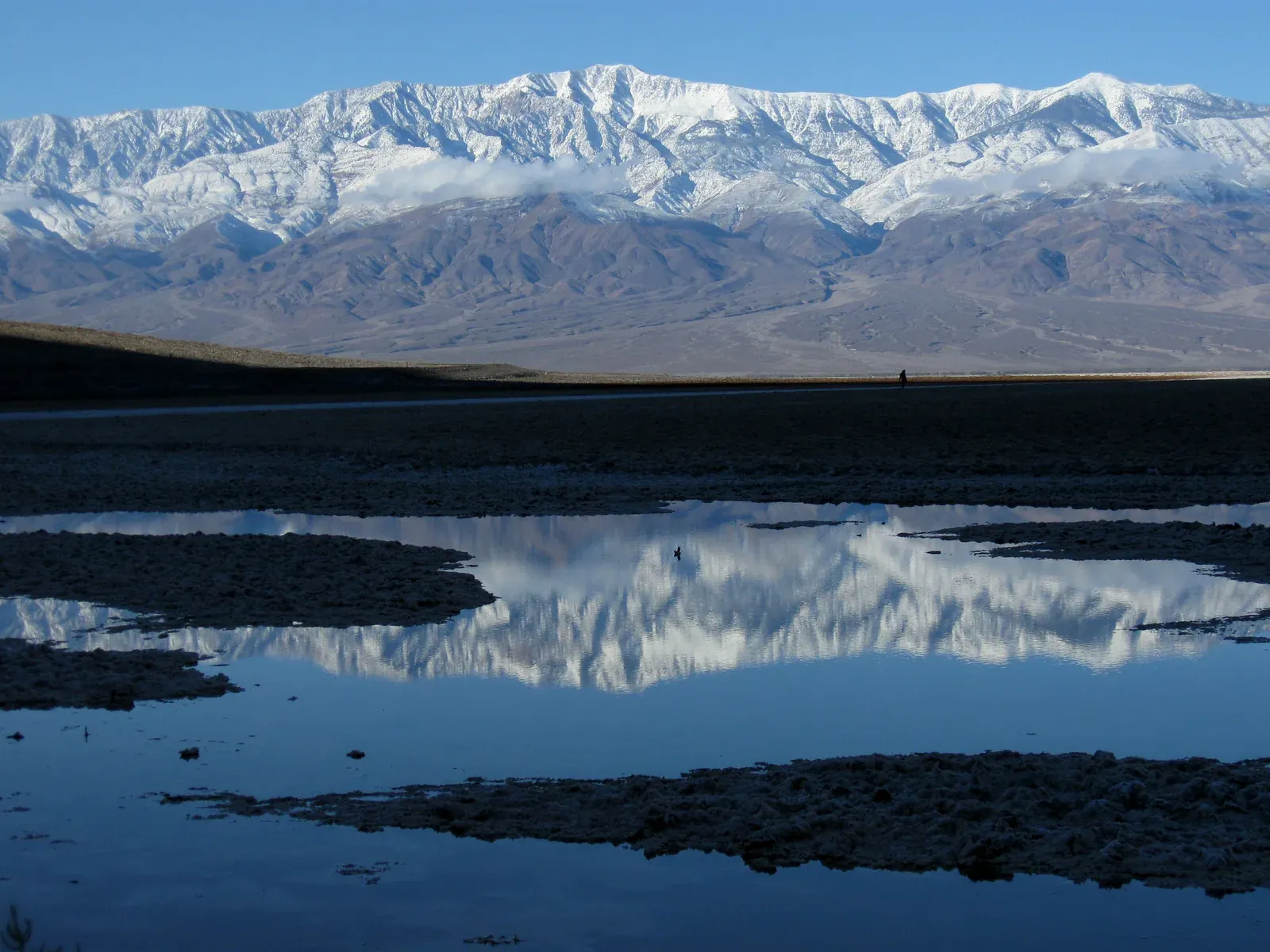
Badwater Basin sits 282 feet (86 m) below sea level, the lowest point in North America. According to the park's Badwater Basin page, its salt flats cover nearly 200 square miles (518 sq km). Telescope Peak rises to 11,049 feet (3,368 m) on the west side, more than two miles above the basin floor. From either road, the flats look smooth and open.
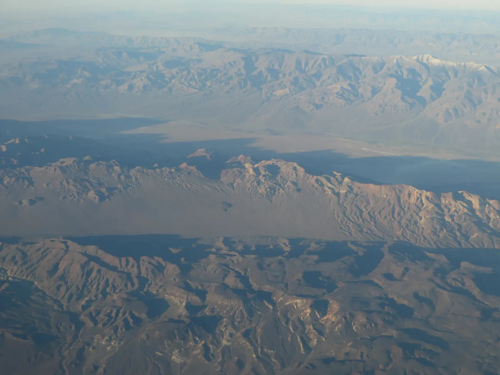
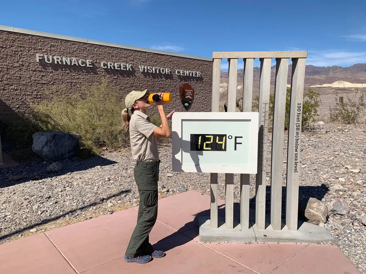
The heat comes from the shape of the place. According to the NPS weather page, the valley floor sits below sea level and is walled in by steep mountain ranges, so heat gets trapped, and air sinking into the valley is compressed and heated on the way down. "The world record highest air temperature of 134°F (57°C) was recorded at Furnace Creek on July 10, 1913." The average high is 116°F (46.7°C) in July and 115°F (46.1°C) in August. The 116°F high reported for August 17 was one degree above the August average.
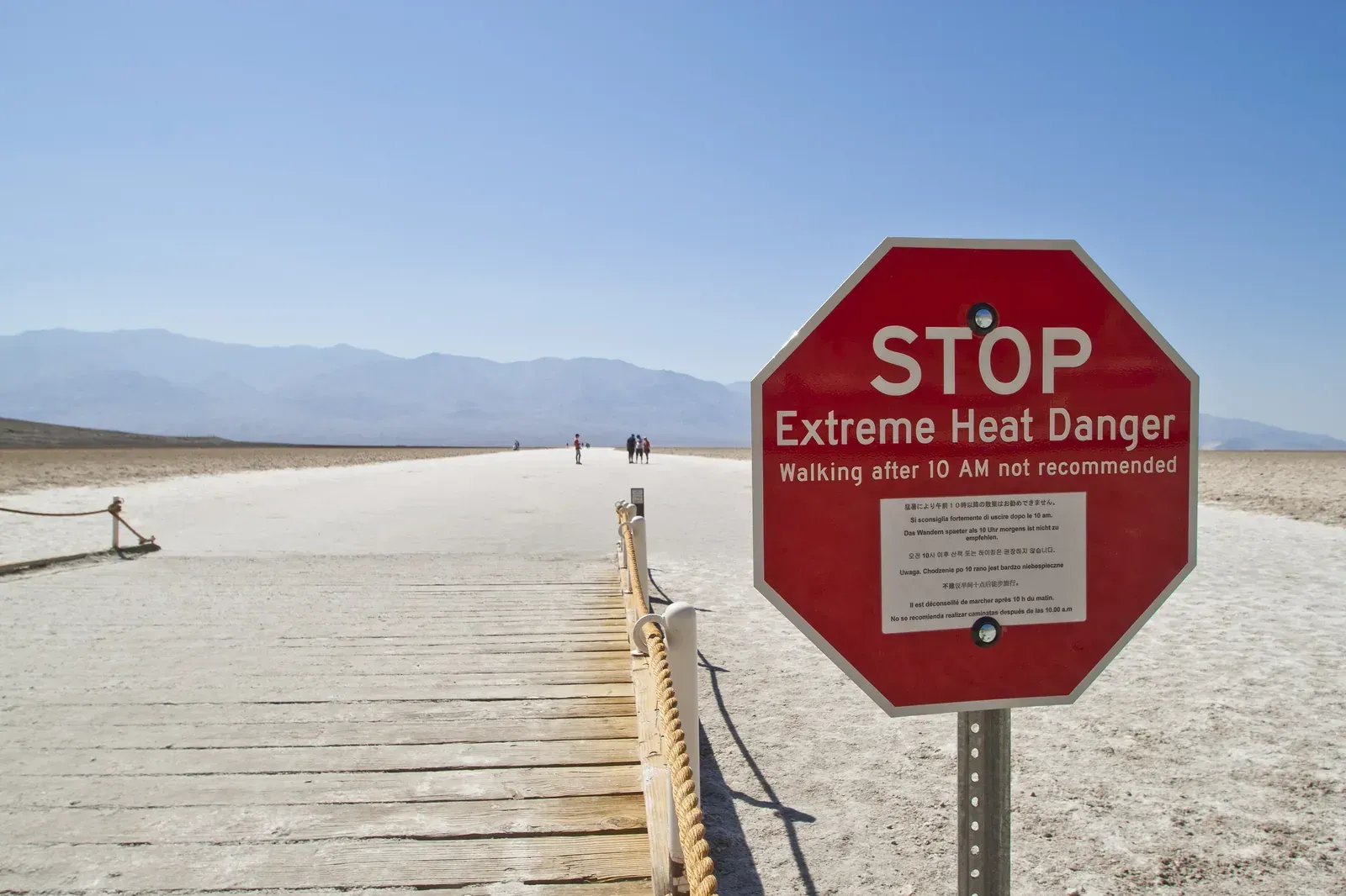
The park's safety page says "Summertime temperatures can be as high as 130°F (54°C) with nighttime temperatures of up to 90°F (32°C)." Its advice is in capital letters for a reason: "DO NOT hike in the valley/lower elevations when it is hot!" The Badwater Basin page adds "HIKING NOT ADVISED AFTER 10AM IN THE SUMMER," and the backcountry map goes further: "Heat and very low humidity create extreme dehydration and heat stroke potential during summer. We do not suggest lower elevation hiking between May and October."
Walking on the flats is not like walking on pavement. The salt polygons that make Badwater famous form as groundwater rises and evaporates, and the park notes the crust can be thin over mud. The park describes the walk out to see the polygons as an easy 1.5- to 2-mile (2.4 to 3.2 km) roundtrip, and the same page carries the warning against hiking after 10 a.m. in summer. After big storms the basin floor can also hold standing water, as it did after the 2023 storms.
What to Do if Your Vehicle Gets Stuck
The park's sixth planning point is the one most backroad drivers have heard in some form. "If your vehicle becomes disabled, staying with it is often the safest choice. It provides shade and shelter, and it's far easier for search teams to spot than a person on foot in open terrain." Think of how small one person looks against nearly 200 square miles of white salt, and the reasoning is easy to follow.
The park's Backcountry Roads page spells out the longer version. "It is best to stay with your vehicle if it breaks down. On main roads, another traveler should come along sooner than you could walk for help. Leave the car's hood up and/or mark the road with a large X visible to aircraft. If you decide to walk out, stay on the main roads-do not cut cross-country. If it's hot, walk out only if you can carry sufficient water and wait until after sundown. Leave a dated note describing your plan with your vehicle."
Notice that the release says "often," not "always." Every situation is different, and nothing in the record tells us what choices the two men had in front of them. This section is about what the park tells every visitor to plan for ahead of time, so the decision is made at home and not in the heat. If I were stuck on a valley-floor road in August, my plan would be to stay put, rig shade off the vehicle, drink the water I brought, and send an SOS instead of starting to walk.
The NPS outdoor emergency plan says the same thing in general terms: "Stay put. Changing location will make it difficult for authorities to find you." It also suggests ways to be seen, like a signal mirror, a flashlight, or a whistle. Put the hood up, lay anything bright on the ground, and stay in the shade during the hottest hours.


.jpg)
.jpg)
.jpg)
.JPG)
.jpg)
.jpg)
Calling for Help With No Cell Service
Most of the park has no cell reception. The Backcountry Roads page says reception is nonexistent in most areas, and the safety page says there is "limited to no cell phone service" in the backcountry. In the United States the emergency number is 911, but a phone only reaches it with a signal. Without one, the rescue clock does not start when you get stuck. It starts when someone who can help finds out. On August 17, according to the release, that happened when the companion reached a passing motorist and then the visitor center.
The park's fifth planning point covers it: "Bring a way to call for help where cell service may not reach, such as a satellite communicator or emergency beacon." The safety page also recommends "some sort of communication device, like a spot device or satellite to make emergency phone calls." A device like the Garmin inReach lets you start a rescue from where you are, without anyone walking out.
Garmin's own manual lists a few conditions that matter. "Before you can use the SOS function, you must have an active satellite subscription. Always test your device before you use it outdoors." It also needs a clear view of the sky. When you press SOS, it "sends a message to the Garmin Response team, and they notify the appropriate emergency responders of your situation." Steven covered what a Garmin rescue looks like in The 10,000th SOS: What a Garmin inReach Rescue Actually Looks Like, and he wrote about another option in his onX SOS review. If your phone has a satellite feature, check before the trip that it works where you are going. Don't assume.
A device is not the whole plan. The park's second planning point is "Tell someone your plans — where you're going and when you expect to return." The safety page says to write down your itinerary and "designate an emergency contact to share it with." The Backcountry Roads page recommends traveling with two or more 4WD vehicles on remote, rough roads, and if that is not possible, leaving "a trip plan with a reliable person that will do follow-up on your safe return." A good trip plan names the road, the direction, and the time you will be back on pavement, plus what your contact should do if you are late.
What to Carry on West Side Road
Water comes first. The park's third planning point says "The park recommends at least one gallon of water per person, per day, plus extra for vehicle emergencies." That is about 3.8 liters each. The Backcountry Roads page adds that "A 5-gallon container of water is standard emergency backup," which is about 19 liters, and warns that "Springs and other natural water sources may be dry or contaminated. Do not depend on them." Treat the gallon as the floor. In a stuck vehicle, the extra water is what buys you time to wait.
.jpg)
The same page has a tire list that is more specific than most. It suggests off-road tires, at least one inflated spare (preferably two), a plug kit, a 12-volt compressor, a lug wrench, and a working jack. It also says "Don't rely on GPS, instead take a map," and notes that "Most backcountry road junctions are unmarked, so carry good maps and study them in advance." The safety page adds extra food and water, plus "shelter/blankets," in case you are stranded.
For a general checklist, the NPS 10 Essentials cover it: navigation, sun protection, extra clothing, illumination, first aid, fire, a repair kit, nutrition, hydration, and emergency shelter. On a hot valley road, carry water, shelter, and a way to call for help, and don't skip any of the three. A tarp or windshield shade you can rig off the side of the vehicle takes up very little room.
Fill up before you go. As of the late September 2026 conditions page, the pumps at Furnace Creek and Stovepipe Wells were open 24 hours, while Panamint Springs pumps were closed at night and open from 7 a.m. to 9:30 p.m. Water is available at Furnace Creek, Stovepipe Wells, and Panamint Springs, according to the safety page.
When to Leave It for Another Trip
NPS recommends staying on paved roads during extreme heat. The seventh planning point reads: "During periods of extreme heat, visitors are encouraged to stay on paved roads and avoid hiking at lower elevations." The Backcountry Roads page explains part of the reason when it says that on main roads, another traveler should come along sooner than you could walk for help. A dirt road on the valley floor may not have that traffic, and the release's own phrase was "no other vehicles in the area." The backcountry map's May to October window for avoiding low-elevation hiking is a sensible guide for planning West Side Road as well.
Rain is the other reason to wait. If storms have been over the Panamints, or the conditions page lists closures on nearby roads, a valley-floor road can be soft even under a clear sky. The November 2025 storm closed West Side Road with just over half an inch at Furnace Creek. The first planning point covers both: "Plan your route in advance and check current road and weather conditions." The park's weather page also links to the NOAA Death Valley weather and climate page.
.JPG)
The route guides agree on timing. Walking Wild and Free lists the best seasons as October through May, and Ordealist suggests November through April. Picking those months does not make the road safe on its own. Help can still be hours away in January, so the water, the trip plan, and the satellite communicator go along no matter when you drive.
Rental Cars and Visitors From Abroad
If you are driving a rental car, check the contract before you turn onto gravel. The Backcountry Roads page is blunt about it: "Most vehicle rental agreements restrict vehicles to paved roads. Check your contract and be aware that the rental company can charge you for damage to the vehicle outside of the contract agreement specifications." It also says "Towing charges are high and AAA often doesn't cover tows on dirt roads."
It is also fair to keep the risk in proportion. The park's safety page says "Most deaths in Death Valley are caused by single vehicle rollover accidents on the park's long, winding roads." Heat and stranding are not the most common danger, but they are the one a valley-floor dirt road brings in summer. The Furnace Creek Visitor Center is open daily from 8 a.m. to 5 p.m., and it is the best place to ask a ranger about current road conditions before you head anywhere unpaved.
Before turning onto West Side Road, run through the park's guidance one more time. Each line below comes from the NPS pages quoted above.
- Check the conditions page and the forecast the morning you go.
- Leave a written plan with someone who will follow up if you are late.
- Carry at least a gallon (3.8 L) of water per person per day, plus extra for the vehicle.
- Make sure the vehicle has the clearance the road calls for, and that your rental contract allows dirt roads.
- Bring a satellite communicator or emergency beacon with an active subscription, tested before the trip.
- If the vehicle gets stuck, plan to stay with it.
If You Go
West Side Road follows the western edge of Badwater Basin and provides access to the canyon roads in the Panamints. Plan it for the cooler months, check the conditions page the morning you leave, and stop at Furnace Creek to ask a ranger about recent rain. Carry more water than the park's minimum, a way to call for help, and a plan someone else is holding.
If Death Valley's backroads are on your list, Lippincott Pass: Death Valley's Racetrack Road covers another one. Steven's post on monsoon flash floods covers summer storms on Southwest routes in more detail, and his inReach SOS post is worth reading before you buy a satellite communicator.
Pierre Michel Formosa was 68 and a visitor from France. The park's August 21 release said the Inyo County coroner would determine the cause and manner of death. The superintendent closed his statement by saying the park's thoughts are with his loved ones. The guidance the park published alongside that statement is meant for every one of us who drives these roads, and it is worth taking along on the next trip.
About the Author
Brent Conklin
Owner of Whiskey7backroads and avid explorer. I am a Ham Radio extra class operator and frequent the Old Miss Net. I have been married for 37 years to Cheryl and we have 2 boys and 2 dogs.